Rain ETA — under the hood
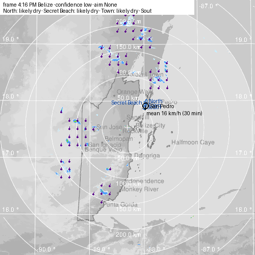
No rain heading for the island in the next 90 minutes; nearest echo 50.6 km to the WSW (light), moving S at 14 km/h.
Frame 3:16 PM Belize (estimated), 17 min old at run · generated 3:33 PM · confidence low · flow coherence 0.89 · rain pixels 1300 · field 14.2 km/h S · 8.9 s / 131 MB
Decoded field + flow colours = rain class (blue light → green moderate → dark green strong → yellow heavy → red extreme); purple arrows = motion per 10 min; magenta = target cell at onset
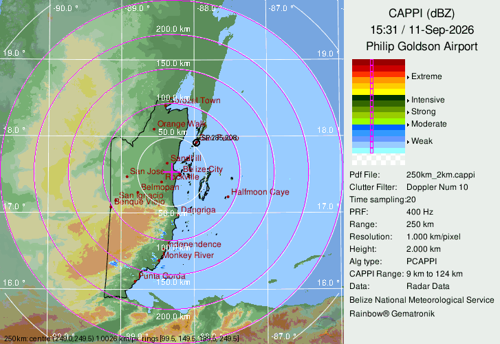
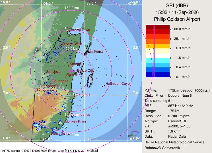
georef check (250 km) · georef check (SRI) · nowcast JSON · home
Cells ≥ moderate on the latest frame
| where | from San Pedro | area | motion | approaching |
|---|---|---|---|---|
| ~115 km N of Chetumal | 177.9 km N | 10.1 km² | 18.8 km/h SSW | yes |
| ~45 km N of Bacalar Chico | 74.1 km NNE | 17.1 km² | 14.2 km/h S | yes |
| ~60 km W of Orange Walk | 125.8 km W | 4.0 km² | 12.2 km/h S | yes |
| ~30 km W of Sandhill | 81.8 km WSW | 6.0 km² | 15.6 km/h SSE | no |
| ~40 km NE of Lighthouse Reef | 100.2 km ESE | 8.0 km² | 11.0 km/h S | no |
| ~100 km E of Lighthouse Reef | 159.7 km ESE | 11.1 km² | 11.0 km/h S | no |
| ~20 km W of San Ignacio | 158.3 km WSW | 4.0 km² | 11.4 km/h S | no |
| ~40 km NW of Independence | 143.7 km SSW | 3.0 km² | 12.0 km/h S | no |
National shadow regions private — graded by the scoreboard, never shown on the site
| region | state | onset min | end min | peak | aim | conf | series (level, 0–120 min) |
|---|---|---|---|---|---|---|---|
| Corozal | dry | — | — | — | — | low | 0 0 0 0 0 0 0 0 0 0 0 0 0 |
| Caye Caulker | dry | — | — | — | — | low | 0 0 0 0 0 0 0 0 0 0 0 0 0 |
| Belize City | dry | — | — | — | — | low | 0 0 0 0 0 0 0 0 0 0 0 0 0 |
| Cayo / San Ignacio | dry | — | — | — | — | low | 0 0 0 0 0 0 0 0 0 0 0 0 0 |
| Belmopan–Hummingbird | dry | — | — | — | — | low | 0 0 0 0 0 0 0 0 0 0 0 0 0 |
| Dangriga–Hopkins | dry | — | — | — | — | low | 0 0 0 0 0 0 0 0 0 0 0 0 0 |
| Placencia | dry | — | — | — | — | low | 0 0 0 0 0 0 0 0 0 0 0 0 0 |
| Lighthouse Reef | dry | — | — | — | — | low | 0 0 0 0 0 0 0 0 0 0 0 0 0 |
| Turneffe | dry | — | — | — | — | low | 0 0 0 0 0 0 0 0 0 0 0 0 0 |