Tropical storms Atlantic basin
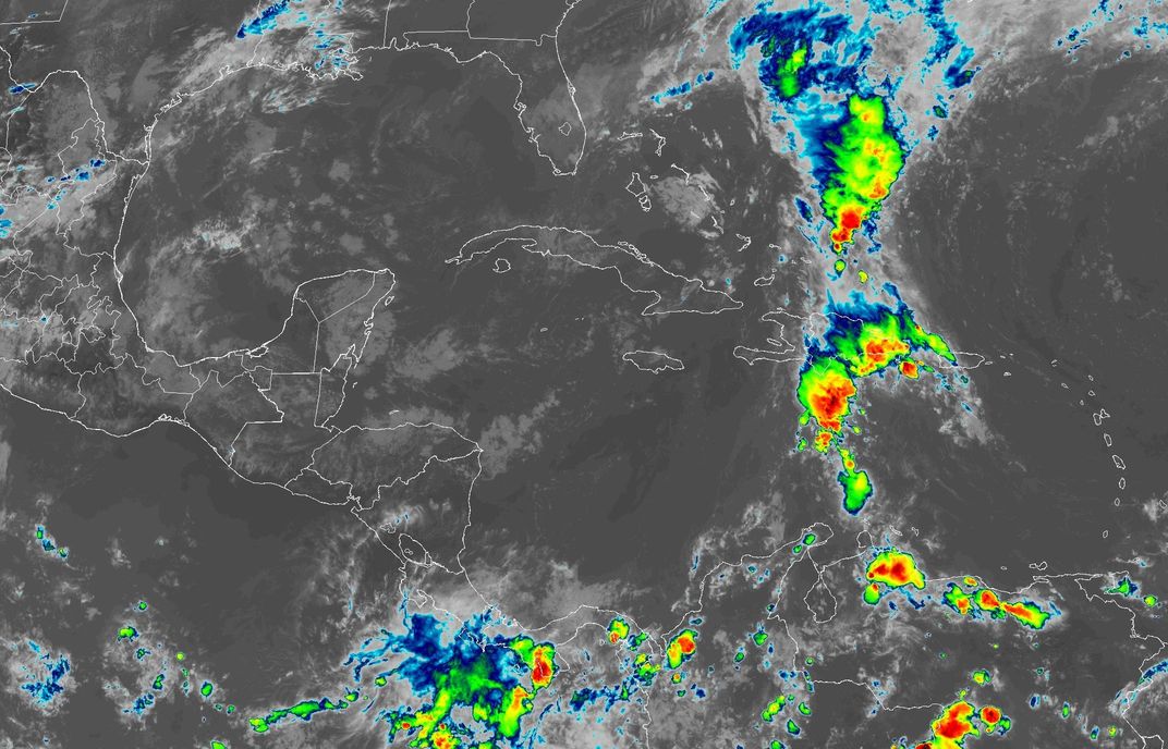
Satellite clouds around Belize
Pinch or scroll to zoom, drag to move, double-tap to zoom in.
grey: low clouds or cleargreen / yellow: showersred / black: strong storms, very cold cloud tops
Colour means a tall cloud: green, then yellow, red and black for the highest, coldest tops, with the heaviest rain and lightning underneath. Watch which way the coloured patches drift to see where the storms are heading; San Pedro is the yellow ring.
The clouds as your eye would see them from space. At night the picture switches to infrared, with city lights on the ground; San Pedro is the yellow ring.
Imagery: NOAA/NESDIS STAR, GOES-19 (public domain)
All quiet in the Atlantic
The National Hurricane Center lists no active Atlantic tropical cyclones (1 active in other basins, which do not affect Belize). A storm banner appears across the site only when NHC's forecast track comes within 600 km of Ambergris Caye in the next 5 days, Belize has a 10% or greater chance of tropical-storm winds, or a watch or warning is issued for Belize.
Hurricane season runs 1 June – 30 November; the Belize peak is late August through October. Check the NHC 7-day outlook for developing systems before they are named.
WeatherNext tracks Google DeepMind AI ensemble
Google's WeatherNext 3 runs 64 versions of the atmosphere at once. It publishes no cyclone track file we can read automatically, so instead of a cone this block reads the ensemble's wind over San Pedro and asks a single question: how many of those 64 runs bring tropical-storm-force wind (63 km/h sustained) to the island on each day?
Read this beside the NHC, never instead of it. WeatherNext is experimental research data, it is not produced or endorsed by any weather agency, and it does not replace official alerts. Its freshest readable run is already about seven and a half hours old, so a fast-changing system will show up on the NHC advisories first. The percentages are worked out from the spread of the 64 runs, which Google publishes as percentiles rather than as the runs themselves.
© 2024-6 Google LLC, whose machine learning models were used to create the experimental data made available under the following licence terms https://storage.googleapis.com/weathernext-public/terms-of-use.pdf. This data is intended for experimental modelling only and is not intended, validated, or approved for real world use. Weather Lab cyclone tracks are published by Google as manual CSV/ATCF downloads only; there is no feed to ingest.
Source: NOAA National Hurricane Center (storm list, forecast advisory, wind speed probabilities and public advisory, via the US National Weather Service). Closest approach is measured from Ambergris Caye along the forecast positions of the storm's centre for the next 5 days; the cone of uncertainty and the wind field are on the NHC links. Official Belize watches and warnings come from the National Meteorological Service and NEMO.