Now in San Pedro
Met Service says Morning Forecast · Saturday, September 12, 2026 | 06:00 AM
Sunny skies with cloudy intervals today, along with a few showers and isolated thunderstorms to develop mainly along coastal areas this morning, then gradually decreasing. Tonight skies will be cloudy at times along with a few outbreaks of showers and thunderstorms to redevelop mainly over southern and some coastal areas.
Outlook: For sunday and sunday night is for generally fair weather to prevail with only isolated showers or isolated thunderstorms , except for the south where a few more can be expected early morning.
Source: National Meteorological Service of Belize · full text, marine forecast, radar
Rain ETA at the house · radar extrapolation, experimental
🌦️ Rain likely at the house from ~9:20 AM (in ~34 min), strong (~18 mm/h), easing by ~9:50 AM. Cell moving W at 30 km/h from ~35 km SE of Bacalar Chico, growing.
Confidence medium · based on radar frames to 8:30 AM Belize · updated 8:46 AM · how it sees the radar
Radar is rain coming?
250 km loop · what's moving toward the island
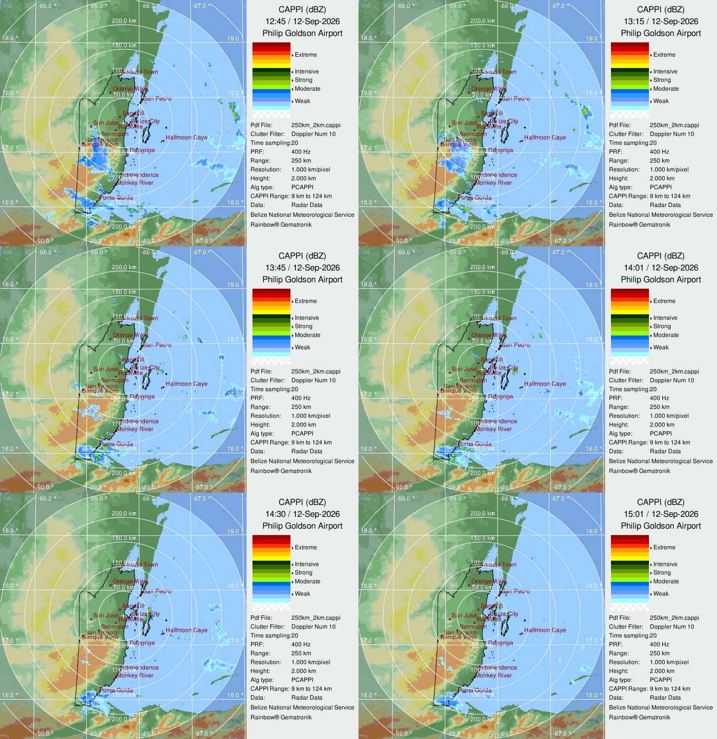 Latest frame ≈ 8:15 AM Belize08:15 local = 14:15 UTC on the image · UTC−6
Rainfall intensity · how hard it's raining, mm/h (175 km)
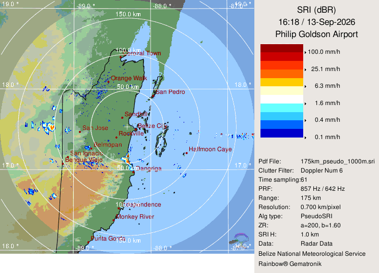 Latest frame ≈ 8:15 AM Belize08:15 local = 14:15 UTC on the image · UTC−6
Met Service radar at Philip Goldson, image 0 min old · 50 km island detail
Next 7 days 4-model blend · model-by-model
Agreement = how closely ECMWF IFS, ECMWF AIFS, GFS and ICON match each other on that day's high and rain total. "Disagree" means treat the numbers as a range, not a promise.
Tropics NHC · 25 min ago
No active Atlantic tropical cyclones. Storm page